Spatial analysis using GIS can provide key insight in fields as diverse as public health, demographics, education systems, city planning, municipal event planning, earth science, and ecology, to name just a few.
With four GIS courses under my belt, I am currently seeking a GIS internship or job opportunity. If you are interested in talking about what I can do for you, I invite you to get in touch!
Keep scrolling to see information about my skills and my GIS projects.
With four GIS courses under my belt, I am currently seeking a GIS internship or job opportunity. If you are interested in talking about what I can do for you, I invite you to get in touch!
Keep scrolling to see information about my skills and my GIS projects.
|
|
Skills
I have completed GIS classes at Foothill College and Cuesta College.
Thus far, my skills and knowledge include:
Thus far, my skills and knowledge include:
|
|
Projects
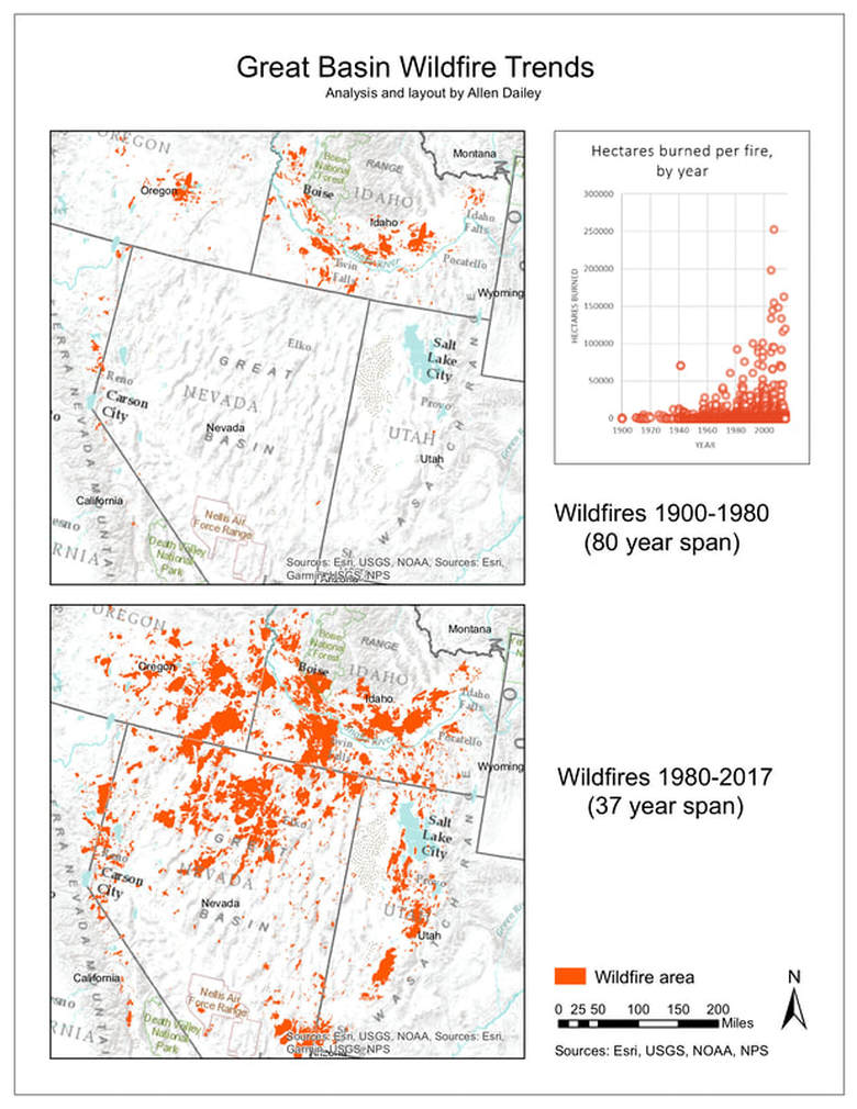
Displaying wildfire trends
For this small project, I found data on areas and dates of wildfires in the Great Basin. To emphasize the recent rapid increase in fires, I juxtaposed two map images, one with older fires and one with newer fires.
Georeferencing a historical map
|
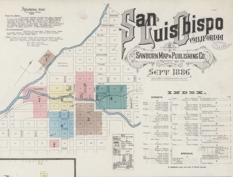
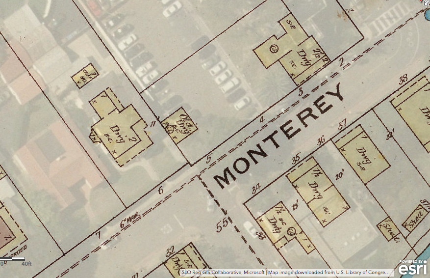
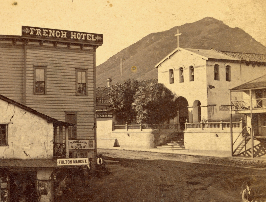
For my final project in my Introduction to GIS course at Cuesta College, I volunteered to serve the History Center of San Luis Obispo County by digitizing an 1886 map of San Luis Obispo and creating an online product available to the general public.
I georeferenced the 1886 map using ESRI ArcMap, shared it as a tiled map service on ArcGIS Online, and made a StoryMap with this map along with many historical photographs of the town and a point layer that showed the location of the photos. I absolutely loved this project, since I got to do some virtual time-travel and indulge my fascination with historical maps. Now I can practically visualize what downtown San Luis Obispo looked like in the days of the Wild West, and I hope you can, too, if you check out my StoryMap online. |
|
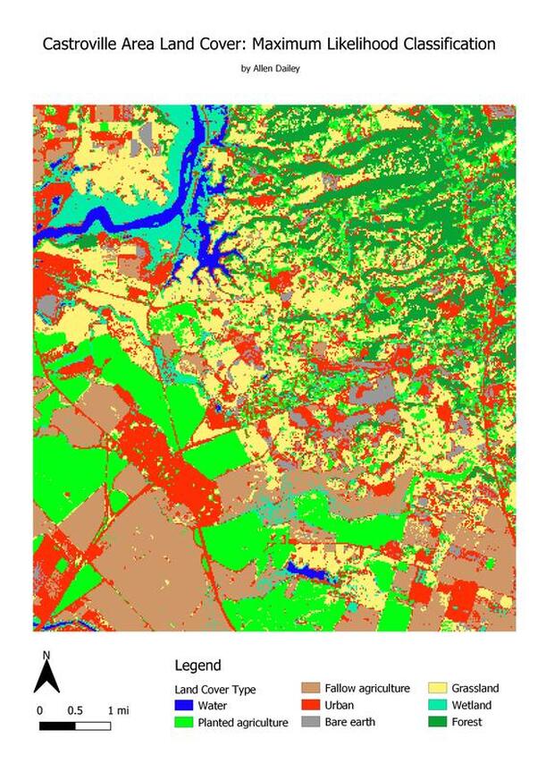
Mapping land cover with satellite imagery
For an assignment in my Remote Sensing class, I used QGIS to perform a supervised classification on Landsat imagery of part of the Monterey Bay area, producing a raster layer of land cover. I gained experience in creating training areas and, later, validation samples, which I used for an accuracy assessment.
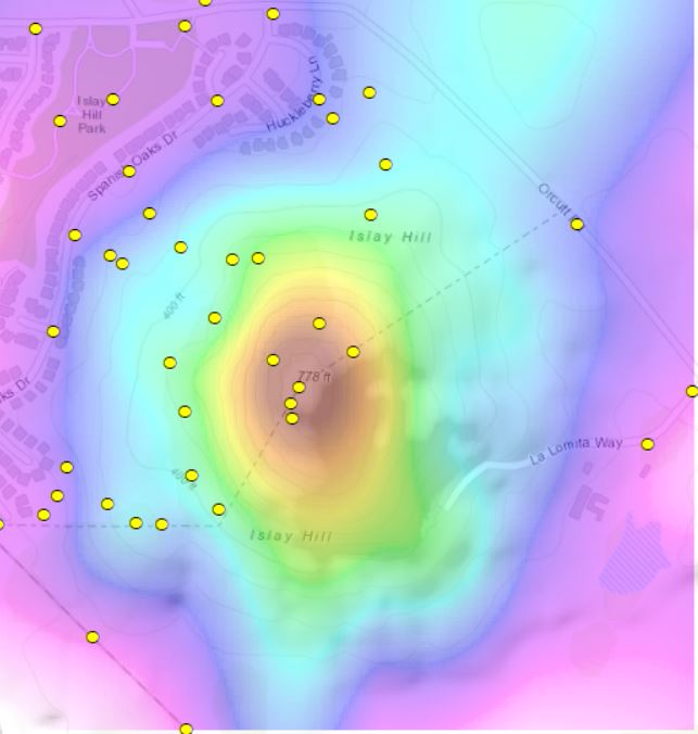
Mapping elevation
To create this map of the elevation of Islay Hill in San Luis Obispo, I collected point elevation data in the field and then ran a spline interpolation. In this image, the yellow points are my data collected in the field, and the color indicates elevation and is based on the data from the points. The topographical basemap is underneath, for reference, and the contour lines match up fairly well with my own elevation model.
Creating a landcover feature class
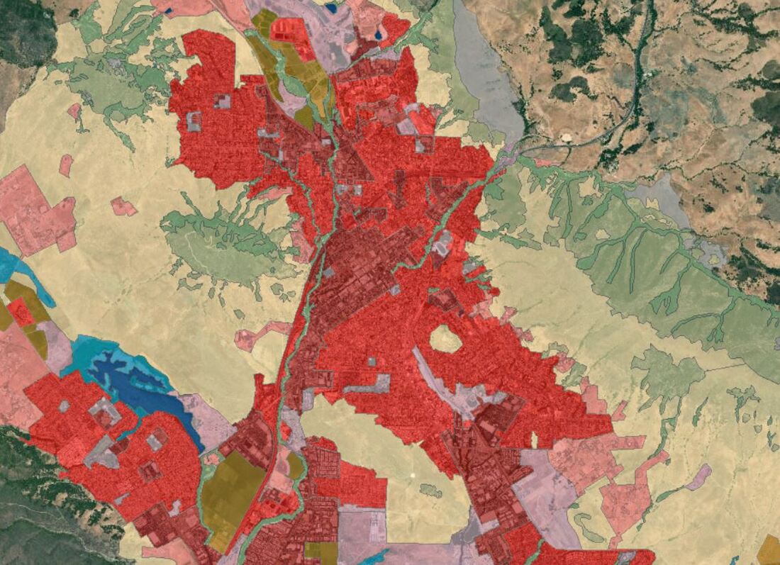
As my final project for my GIS Data Acquisition and Management course, I created a vector landcover feature class of the San Luis Obispo area. It is part of a feature dataset for which I created topologies and domains. I used the same classifications as the National Land Cover Database, as published by the Multi-Resolution Land Characteristics Consortium (MRLC).
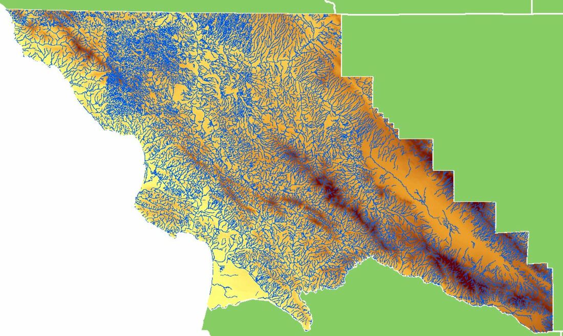
Clipping layers to SLO County
For a class assignment, I acquired elevation and stream layers that extended past the boundaries of SLO County. Then I mosaicked the elevation rasters, added a layer with all California counties, created a new layer with only SLO County, and clipped the elevation and stream layers to it.